
Helping researchers monitor and protect bat colonies
Even with proper safety equipment, entering a cave puts one at risk of several hazards, including dehydration, hypothermia, rockfall, trips and falls, or simply getting lost. Researchers of bat colonies risk this to collect data for bat and human safety. What if they used LiDAR instead?
The second team from Michigan Technological University (MTU) for the 2020 TiM$10K Challenge at SICK included Garrett Smith, Max Heidacker, Spenser Fata, Ethan Baker, Adam Persson, and Bob DeJonge. Their advisor was Dr. Wayne Weaver, an Associate Professor in the Department of Electrical and Computer Engineering. The Cave Map and Bat Counter (CMBC) created for the challenge aims to help Michigan researchers streamline their data collection.

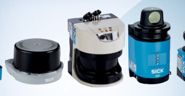
So, what is the TiM$10K Challenge? In this challenge, SICK reached out to universities across the nation that were looking to support innovation and student achievement in automation and technology. Participating teams were supplied with a SICK 270° LiDAR, a TiM, and accessories. They were challenged to solve a problem, create a solution, and bring a new application that utilizes the SICK scanner in any industry.
Why Focus on Bats?
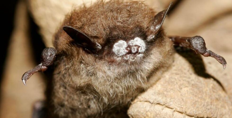
Researchers in the MTU Forestry Department and the Michigan Department of Natural Resources (MDNR) are studying white-nose syndrome in bats. White-nose syndrome is a fungus that grows on the faces of the bats while they sleep.
“The fungus causes irritation to the bats to the point that they wake up during hibernation, which causes the bats to burn so much energy that they starve to death during winter,” DeJonge explained.
On top of being terrible for the bats, this has implications for humans as well. Bats are one of the few natural predators of mosquitos.
“When the bats die off, the mosquito population grows, and so does the risk of them transmitting diseases to humans,” Smith added.
At the moment, bat researchers with the MDNR have to walk through caves by flashlight and count the bats they see, which can be both dangerous and inefficient. The MTU team’s solution using LiDAR technology is not.
Developing the Cave Map and Bat Counter
By utilizing the SICK 270° LiDAR, the CMBC is able to conduct two functions. First, it can be placed at the entrance of a cave to count how many bats are entering and leaving. Second, it can use 3D imaging to scan an area without bats, then compare it to a similar scan of an area where bats hibernate so researchers have a simpler time counting.
“This would be especially useful in verifying the widely-held hypothesis that the temperature of a cave effects the spread of white-nose syndrome,” Heidacker said.
The benefits of such a device are inherent:
- No safety risk to researchers from entering caves
- Faster and more accurate data collection
- 24/7 data collection
Another benefit of the CMBC is its portability. Straps on its sides allow researchers to transport it as a backpack, and handholds have been included to allow it to be carried as a suitcase. What’s more, the CMBC’s acrylic dome allows it to be protected as it is moved between locations.
“At 27 pounds, it can be easily carried by a single person,” Baker said. However, not everything in CMBC’s development was so simple.
Unexpected Pitfalls in Development
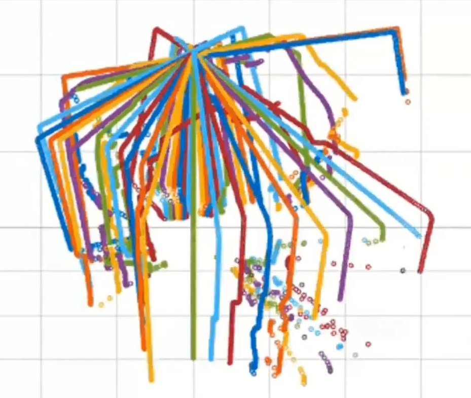
A 3D compilation of scans
The MTU team was hit hard by COVID-19. While the team had solidified their design and programming, they weren’t able to sufficiently test the entire device, only components of it.
In addition to these problems, the MTU team was forced to cut a few of their initial goals out.
“We were unable to get a cohesive final prototype that would be taken into a cave and tested,” Persson said. “For the 3D scan, it would’ve been ideal if the code could detect the bats solely based on the Received Signal Strength Indication (RSSI) values of the reading, thus eliminating the need to go in and take an initial scan.”
Still, the team saw some positives to the development of the CMBC. While the device was originally meant to help the MDNR gather data on bats, they have found other possible uses for it.
“This device can be used to track how many people enter or exit an area with the proper setup, and it could be used by contractors and architects to easily measure rooms in ‘as is’ condition,” Fata explained. “The MDNR also indicated that they could use it to determine the canopy density of a section of forest.”
Register for the 2020-2021 TiM$10K Challenge
![]()
SICK is now accepting entries for the TiM$10K Challenge for the 2020-2021 school year! Student teams can register online by September 14, 2020. Student teams are encouraged to use their creativity and technical knowledge to incorporate the SICK LiDAR for any industry in any application. Advisors/professors are allowed to guide the student teams as required.
This contest was supported by PMMI Foundation’s U Skills Fund. PMMI Foundation works to grow awareness of careers in packaging and processing, providing assistance to schools and programs that develop students to excel in the industry.